ResponDrone to integrate 3D mapping technology to enhance situation awareness for first responders
May 23, 2021
“…I can take a million dollar aerial apparatus and stick in the air, or I could go fly a drone and get that situation awareness. And then the ability to transfer that information to other people would be a key piece.” (Firefighter Supervising Field Responder)
This is just one quote from thousands given in interviews of over 7,000 first responders across the USA. This info was provided in recent research conducted by the US National Institute of Standards and Technology (NIST) (Public Safety Communications Research) program PSCR.
The results of the survey highlight the critical importance of accurate location information for first responders (especially about infrastructures) when called on to deal with a fire, a flood or any other natural disaster. This particular firefighter, perhaps unwittingly, also points to the advantage in harnessing the advantages of actually using less expensive technology to provide cutting edge capabilities for emergency crews.
As a project dedicated to providing first responders with state-of-the-art situation awareness capabilities for use in emergency situations, ResponDrone seeks to integrate a unique mapping solution in its overall operational system. The aim is to provide the emergency teams on site with tools that help them to better understand their working environment. Such knowledge may often mean the difference between saving or endangering lives.
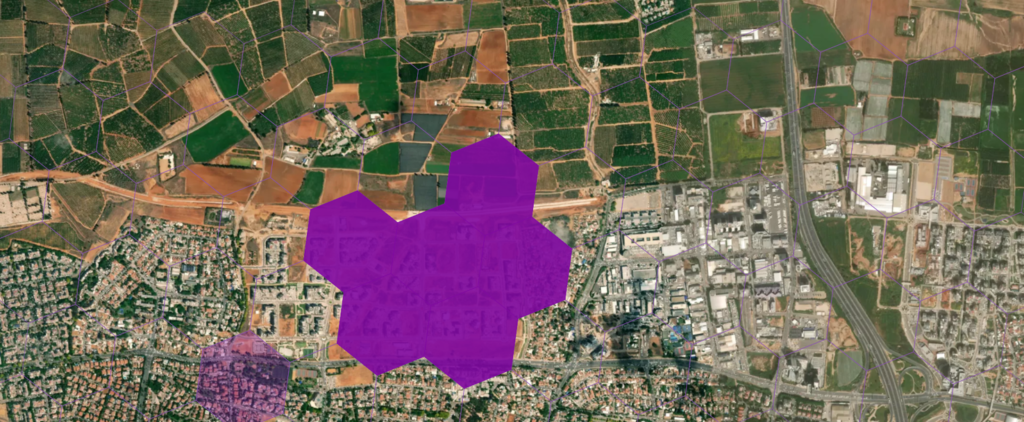
If an ambulance driver uses an outdated map to arrive at the scene of an accident, or a firefighting crew can’t get to the scene of the forest fire as roads have been blocked due to falling trees as a result of the wildfire, the results could be fatal. Consequently, the need to provide precision 3D mapping as fast as possible to rescue teams has been identified by ResponDrone as a key capability to attaining its goal of maximizing situation awareness for first responders.
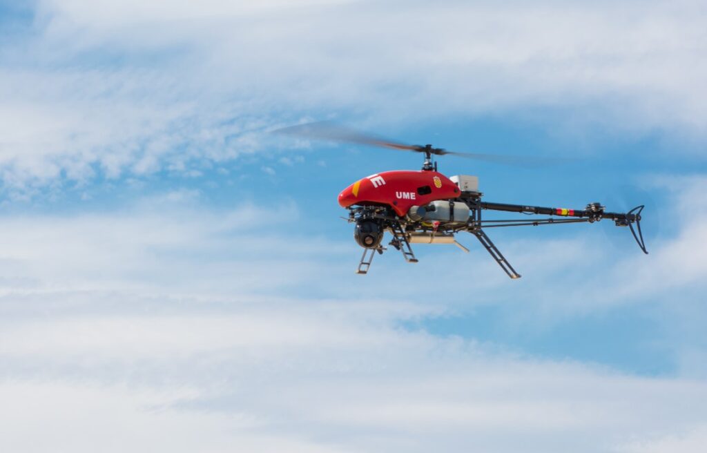
The project, which uses Alpha Unmanned Systems 800 model and the brand new Alpha 900, has signed an agreement to integrate Hivemapper’s latest, crowdsourced mapping technology. It works as follows: the platform flies a mission over the area where an updated 3D map is needed. The resulting video is then processed by Hivemapper and turned into an up-to-date 3D map. This is further proof of the modular approach ResponDrone has adopted in the design of its platform, allowing easy expansion of the platform using state-of-the-art technology, and giving first responders access to those tools.
Besides these clear operational advantages, this technology is significantly more cost-effective than other leading and commodity technologies.
Hivemapper, often referred to as the “Waze for drones”, is building a global, decentralized mapping network based on imagery collection from commodity drones and private vehicle installed dashcams that is transformed via dedicated technology into highly accurate 3D maps. It is based on a contributor network in over 80 countries worldwide, with modest financial compensation for those investing their time in the crowdsourcing efforts to contribute to the overall mapping campaign.
Use of the Hivemapper technology by ResponDrone, will first and foremost serve the needs of the emergency services by providing the teams on the ground with the highly focused and updated situation awareness they need.
Later on, the broader community will be able to benefit from the updated mapping data via Hivemapper, and thus the impact of natural disasters may be reflected in the mapping app, which otherwise might have taken years to feature on traditional mapping platforms.
This damage assessment will be useful not only for restoration tasks, for both forests or buildings, and for example, will contribute to more precise restoration, budget elaboration, insurance appraisal, etc.